
We stayed at the campground at Carmel Valley for two nights and enjoyed having a home base from which to explore Carmel and Monterey. We also enjoyed having showers that didn't require tokens or quarters, or were on a timer, as well. You can imagine. Timed/token showers loomed ahead...
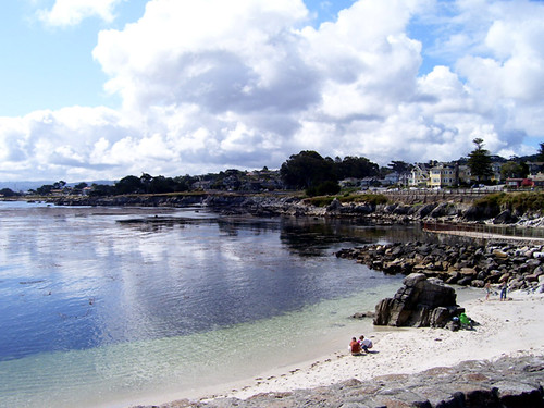
We drove into Monterey, found a wonderful bakery and fueled up with more coffee and chocolate-y almond-y pastries. Heaven! We meandered along the coast, basking in the sun after the fog lifted. So many miles of beach and ocean… We were tempted to go ahead and commit to another night at the site or maybe stay even longer. The original plan was to see the Redwoods, then make it up to Olympic Peninsula, to see Mt Rainier and the fields wildflowers. Or maybe even get to Vancouver, to see the Olympic venues. Getting that far north would mean we couldn't linger for too long in any one place, though. And, however far north we reached, we needed to be able to head back home in time for me to teach on Monday, July 11th. We could make it to Seattle, but would need to pace our way up along the coast, that's for sure. But there in Monterey, we thought, just maybe, we could stay put right there and plan on a long, deep dive into the area … very much tempted by the thought of return visits to Paris Bakery.
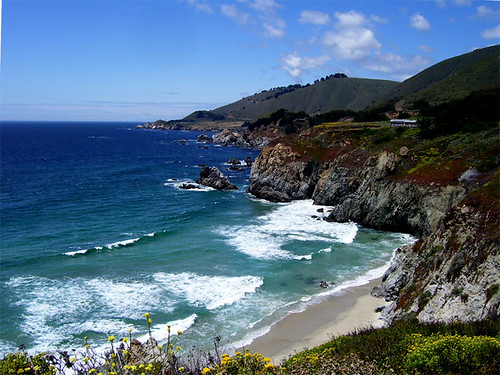
We drove along from Monterey then decided to do 17–Mile drive, stopping at all the marked stops: Pebble Beach, Spyglass Hill, Bird Rock, the Lone Cypress, Pescadero Point.
From the Pebble Beach Resorts brochure:
“Before the automobile had become a way of life, 17–Mile Drive was navigated by horse-drawn carriages from the famous Hotel Del Monte, now the site of the Naval Postgraduate School in Monterey. It was 1881 and excursions through Del Monte Forest and along its spectacular coastline often ended up at a picnic spot at Pebble Beach…”
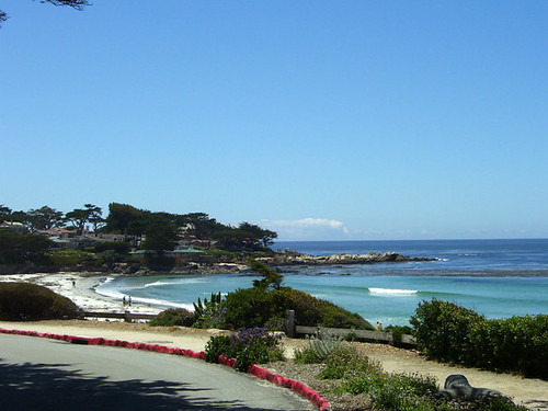
We ogled the views, the big homes with ogle-able private views, paused to whip up lunch (PB&J, fresh fruit and granola bars). We stopped and watched the otters and seals. We made a pit stop at the Lodge at Pebble Beach. In the lobby, there were the most beautiful, huge, paintings that captured the bright sunlight and deep, leggy shadows on pristine white sand beaches. Or, at least that's how I remember them.
Dumbfounded, I ogled those for a while.
But did I get pictures? I was far too spellbound. Alas!
We (I) quickly found that it was hard to choose between being spellbound with enchantment for the beauty of it all and thinking to slip behind the lens of a camera to actually capture it. Sigh.
We came upon Point Pinos Light House and discovered that the park was closed that day! Oh no! We could always come back; or would we? We could certainly improvise and make the best of it. It turned out that we happened upon several other landmarks that we'd normally spend much more time at, only to arrive to closed gates. We are not so easily deterred, as you can see:
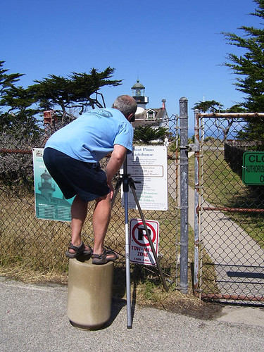
Pt Pinos, navigating the closed gate and fence.
The oldest, continuously-operating lighthouse on the West Coast. Lit February 1, 1855.
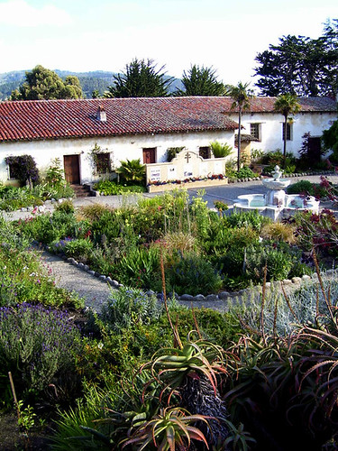
The Carmel Mission, built in 1771 by Father Junipero Serra. Peering wistfully over the stone wall, after closing.
It was about at this point that it occurred to me that one of us was intent on photographing lighthouses and
bridges and the other of us wanted to paint within the garden walls of all the missions along the way. The lighthouses won; the comprehensive tour of California missions will have to wait for another trip. There were plenty of lighthouses and even more bridges, and plenty of mighty fine places to paint along the way, of course.
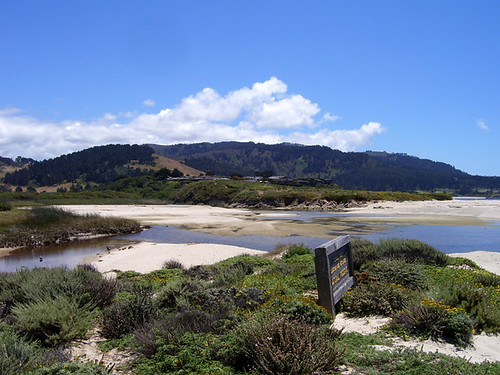
Carmel River Lagoon and Wetlands Natural Preserve
We stopped at Julie Pfeiffer State Park and hiked to the falls. We were really struck by all the clover (Redwood sorrel?) all around us. We plucked one and managed to carefully stash it away so that it survived the rest of trip.
At about this point, I realized there was no way I was jotting down the spots we'd stopped at quickly or accurately enough. No way that the Campsites of Southern/Central and Northern California maps that we'd brought along showed enough detail to help me recall our path for each day. I would need much more detailed maps to refer to. I tried to take photos of signs at each spot, but even just two days into our trip, and not even out of 'Central' California, oh my, we had so many pictures and so many more wishes to return to take pictures, but not enough of a photographic memory to remember where to return to.
Note to self: Take the time to take better notes.
All the photos from the trip are here.
Thursday, September 01, 2011
Drive up the Coast, part 2
Subscribe to:
Post Comments (Atom)

0 comments:
Post a Comment