
In addition to the redwoods, there was, of course, more to see.
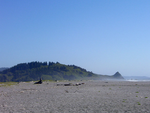
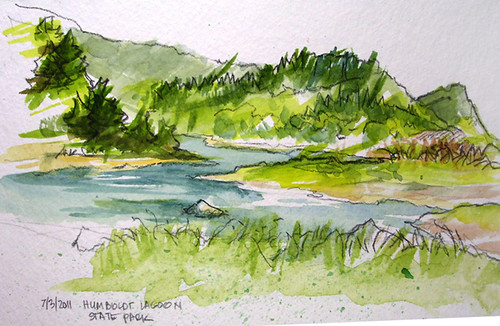
We moseyed over to Humboldt Lagoons State Park, just west of Redwood National Park. Driving the precariously narrow and steep road, having seen lots of large trucks blasting up or down, we were leery. We got halfway down, peered out and went, “Oooooh”. The lagoons are shallow bays between rocky headlands* where coastal wave action has formed a sandy bar separating each lagoon from the Pacific Ocean. The lagoons are resting areas for migratory waterfowl.
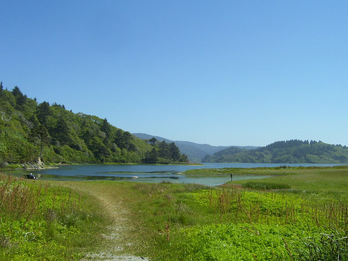
From where we parked, you could gaze out one direction and see only the lagoon:
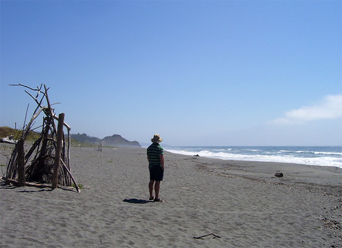
then turning to look the other way, beyond the wide golden beach, the Pacific Ocean:
From the Humboldt Lagoons State Park, California State Parks website and Wikipedia:
Gold-seekers swarmed into the area in 1849 when discoveries were made along the Klamath and Trinity rivers. Prospectors attempted to mine the sandspits along Big and Stone lagoons, but managed to extract very little gold despite considerable effort. In the early 1900's Dry Lagoon was drained by early farmers and several types of crops were attempted but none proved economical. Several dairy ranches were established along the shores of Stone Lagoon. Today the marshland habitat has returned and supports a rich variety of marsh plants, birds and other animals.
We stayed for a while; there was plenty to take in.
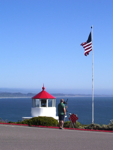
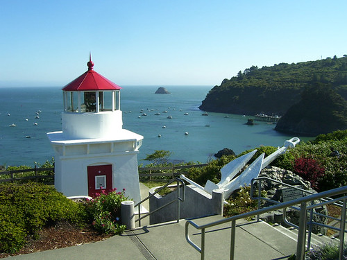
We also stopped at Trinidad Head Lighthouse.
The low, square, brick tower was built in 1871. The light is only 20 feet above ground, but the headland on which it stands gives it an elevation of 196 feet above the sea. From the road, indeed, the tower doesn't seem very tall, but its location affords great photos, looking down at the ocean below.
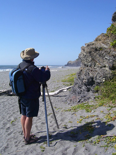
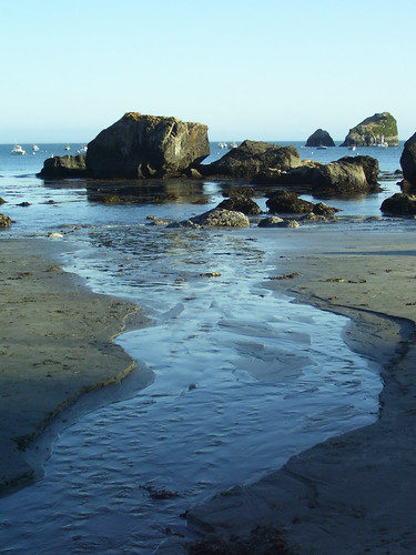
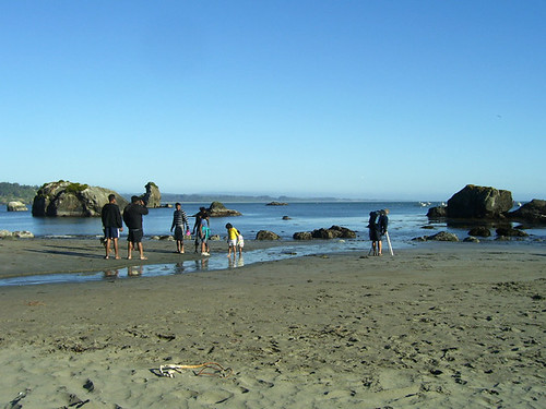
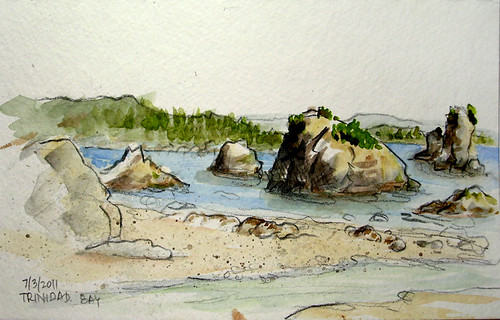
We discovered a trail, hiked down (avoiding the first of several banana slugs) and found ourselves looking out at Trinidad Head* and its many sea stacks in the long shadows of late afternoon. We sighed serenely and pulled out our photo/painting gear and set about doing our thing(s).
Sometimes you have to share the scenery:
*Somewhere along the way, we had a discussion about this geographic term, “head”. J decided, from the context of a conversation he'd had, that it was another term for 'lighthouse'. And I thought it must mean something else, maybe something geographic, because otherwise it would be redundant to call it the Trinidad Head Lighthouse. That would also explain why the place we went to later that was the Something-Something Head was high up on a hill, but did not have a lighthouse. It did have a potty, which made the somewhat misguided detour very worthwhile.
Had we thought to access the internet, we would have known that:
“A headland is a point of land, usually high and often with a sheer drop, that extends out into a body of water. The word is often used as a synonym for promontory.”
(At this point, yes, I clicked to the link that defined 'promontory')
“A headland is often referred to as simply a head, either in context or in names such as Beachy Head or Koko Head.”
Wikipedia, to the rescue.
Clicking more, I've find that clumps of rocks that we were seeing are called sea stacks. Trinidad's sea stacks are part of the California Coastal National Monument, a string of more than 20,000 rocks and small islands along California's 840-mile long coastline. Created by Presidential proclamation in 2000, the National Monument designation ensures the protection of all islets, reefs and rock outcroppings from the coast of California to a distance of 12 nautical miles along the entire California coastline.
That's a lot of coastline, my friends.
The Trinidad area, it reads, “is one of the most spectacular and pristine segments of the California coast, and has been established as a California Coastal National Monument Gateway – an area that offers the best shore-based opportunities to discover and view offshore rocks and islands and their inhabitants.”
Yes indeed.
Friday, October 07, 2011
Drive up the Coast, Part 5: Moseying along
Subscribe to:
Post Comments (Atom)

2 comments:
Very beautiful scenery. Thanks for sharing!
What a wonderful trip! i love your water colors and photos...and learning about this section of the coastline--sea stacks. i would love to go out and follow your path one day...
Post a Comment